Table of Contents
Outdoor fans may have already visited iconic British Columbia nature destinations like Tofino and Whistler, but we can't talk about hiking in BC without mentioning the amazing Glacier National Park of Canada.
Of all the activities available in the park, hiking is usually a favorite. Hikers can enjoy an easy short hike, a somewhat challenging moderate hike, or head out on difficult day hikes. Don't let the mountains scare you off if you're a beginner; there's a trail for every level here!
Also, just a heads up that there happens to be two Glacier National Parks - one in BC and one in Montana. So be sure to plan your trip carefully! This article will be a rundown of the best trails in in BC .
So, if you're ready to climb mountains, let's explore some of the top Glacier National Park trails to hike and the best season to visit!

History of Glacier National Park of Canada
Established in 1886, the Canadian Pacific Railway (CPR) gets credit for seeing the potential in the then untouched wilderness. The area's natural beauty was a tourist draw, even back then. The railway quickly built lodges and hotels to accommodate visitors.
Perhaps the most famous part of the park, Rogers Pass, is named after the railway's engineer-in-chief - Major A.B. Rogers. The Pass itself is now a National Historic Site. As you explore the park, the area's link to its railway roots is more than evident.
When to visit Glacier National Park of Canada
The best time to visit Glacier National Park is in the summer.
From June to mid-September, the park offers pleasant weather and, therefore, safer hiking conditions. In the winter and into the early spring, the entire park, including campsites, trails, and day-use areas, is blanketed with up to two meters of dense snow.
Where to stay in Glacier National Park
There are certainly a lot of guides on where you can stay in the Montana side of Glacier National Park, but what about the Canadian side? There's a bunch of great options when it comes to staying near or at Glacier National Park, including camping, cabins, all the way to hotels and resorts.
Check out our written guide of all the best places to stay in Glacier National Park!
The Best Easy Hikes in Glacier National Park
Bear Creek Falls Trail
The Bear Creek Falls Trail is the perfect way to start your Glacier National Park hiking journey. It's an easy introduction to the countryside, so it's suitable for almost everyone. The trail begins with a downhill walk, which you'll see is rare for the hikes here. As you may have already guessed, the goal of this trail is to make it to Bear Creek Falls.
The scenic falls are where Connaught Creek meets Beaver River, and the water cascading to connect them stretches over impressive rocks. Since the waterfall isn't just straight down, the result is a mist-effect that is very refreshing in the summer.
Length: 580m one way
Time: 30 minutes each way
Trailhead Location: Pickup the Bear Creek Falls Trail about 9km east of the Rogers Pass Discovery Centre.
Elevation Gain: 62m
1885 Rails Trail
In a national park full of mountains, you may be surprised to learn that you can still find longer trails that are mostly flat. The 1885 Rails Trail is one of those. It follows the old Canadian Pacific Railway route with information along the trail about the park's rail history navigating Rogers Pass.
The trail itself is wide with tightly-packed gravel. Although you're not hiking up, you'll still see plenty of mountains, and the tree-lined path gets you into the wilderness in no time. Make sure you don't follow the trail up the railway grade past Illecillewaet Campground. This area is closed to people and is left for the resident grizzly bears to enjoy.
Length: 3.8km one way
Time: 1 hour one way
Trailhead Location: Pickup the 1885 Rails Trail at either Illecillewaet Campground or Loop Brook Campground.
Elevation Gain: 60m

The Best Moderate Hikes in Glacier National Park
Avalanche Crest Trail
To give you an idea of the terrain on the Avalanche Crest Trail, you need only to re-read its name.
During the winter months, this crest is responsible for avalanches of rocks that make it all the way to the TransCanada Highway. This is an out-and-back trail that's ideal for seeing some of the transportation history of the park with your own eyes. Views of the original CP Railroad are plentiful, and it is thought that this was the site of the first views of Rogers Pass back in 1881.
You won't find any trees along the rocky mountain slopes as you climb. But, what you do get are uninterrupted views. Magpies, marmots, and nutcrackers can all be seen here as well.
Length: 5km one way
Time: 3 hours one way
Trailhead Location: Pickup the Avalanche Crest Trail at the Illecillewaet Campground.
Elevation Gain: 989m
Asulkan Valley Trail
The Asulkan Valley Trail is a moderate-day hike suitable for more experienced hikers. The trail is a good combination of easy flat sections and steeper climbs. At least the whole trail isn't uphill, right?
The first half of the trail (about 4km) has little to no elevation gain and follows the path of a lovely creek in the lush forest. If you want to make things easy on yourself, just turn around at this point. Keep an eye out for wildlife along the way!
Beyond the first 4km, the trail gets dicier. And the last section, in true Glacier National Park style, is the most challenging. You climb the top of a glacial moraine and are treated to views of the lower section of the Illecillewaet Glacier. If you're too tired to head back down immediately, a cabin is available to the public at the top, but you need to book this in advance.
Length: 6.9km one way
Time: 3 to 4 hours one way
Trailhead Location: Pickup the Asulkan Valley Trail at the Illecillewaet Campground.
Elevation Gain: 869m

The Best Difficult Hikes in Glacier National Park
Mount Sir Donald Trail
Although this trail now ends abruptly at the junction with the Perley Rock Trail, due to significant rock fall, the Mount Sir Donald trail is still definitely one of the best Glacier National Park hikes.
Originally built as a railway access route, this eastern park hike is not for the faint of heart. It starts out relatively easy with a gradual incline and shares the path with the Perley Rock Trail. When the trail splits left for Mount Sir Donald, you really start to climb.
Watch out for large boulders. The last one-kilometer section of the trail is the toughest with loose gravel, and it's the steepest part. Once you get to the top, enjoy panoramic views of the Bald Hills and the surrounding Selkirk Mountains.
Length: 5.1km one way
Time: 3 to 4 hours each way
Trailhead Location: Pickup the Mount Sir Donald Trail at the Illecillewaet Campground.
Elevation Gain: 1,008m
Hermit Trail
Glacier National Park's Hermit Trail should only be attempted by seasoned hikers. If you have the fitness level, though, the summit views of the ice fields are totally worth it. The out-and-back trail is relatively short, but it's extremely steep. It's actually the steepest trail in the park.
To start out, the trail takes you through BC's famous old-growth forest. You'll then pass by colorful alpine flowers and flowing streams. Once you reach the top, you can either turn around or continue the adventure with a night of backcountry camping. The four available spots are flat enough to pitch a tent.
Pack as light as possible for this trek, and you'll definitely need a backpack if you plan to stay the night.
Length: 3.2km one way
Time: allow 2 to 3 hours each way
Trailhead Location: Pickup the Hermit Trail about 1.5km east of the Rogers Pass Discovery Centre.
Elevation Gain: 819m

What should I bring on my Glacier National Park Hikes?
Remember that most of the trails in this park are considered totally wild. There are no stores or restaurants to help if you get into a jam.
Pack lots of water and snacks to keep you fueled up. A Glacier National Park hiking map couldn't hurt either. Make sure the map is accessible offline since cell reception in the park is patchy at best, especially on the more remote trails.
Another recommendation is to download a useful hiking app to guide you. Just make sure you pick the right Glacier National Park and don't get confused with the one in Montana!

Tips for hiking in Glacier National Park
The main goal of your hiking here should be to have fun, and with a few precautions, you'll have an even better time:
- Always tell someone where you're going and when you'll be back.
- Wear the most comfortable and supportive shoes you have - this isn't the time to break in a new pair of boots!
- Pack as light as possible.
- Check the weather before you head out, and dress accordingly. A few options couldn't hurt, either. The weather is very changeable in the high mountains.
- If you don't want to camp in the park, plan to stay in the nearby towns of either Golden or Revelstoke.
- The best camping spot for hikers is at Illecillewaet Campground. Many of the best hikes in Glacier National Park start and end here.
- Be bear aware. This is grizzly country. Safety tips can be found at some of the trailheads and at the Rogers Pass Discovery Centre.
Explore the wilderness with Pilot!
There should be nothing stopping you from getting out into the Glacier National Park wilderness. The rewards are impressive summits, peace and quiet, and lots of fresh air. Your only challenge will be which of the best hikes in Glacier National Park you should start with!
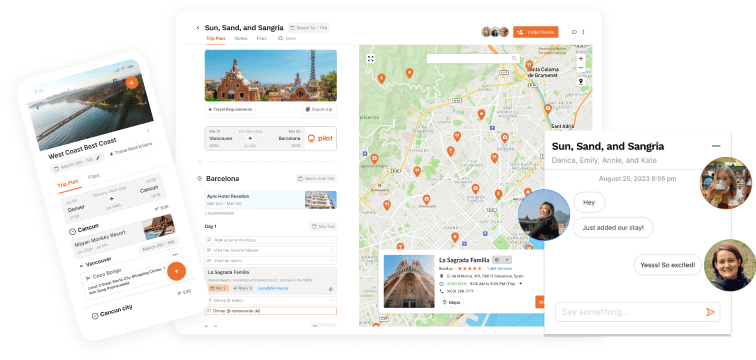
For more help planning the perfect trip to this BC gem, Pilot is here to help.


![Paris Neighborhoods Guide [2024]: Areas to Visit & Avoid!](https://assets-global.website-files.com/63d1baf79ce0eb802868785b/65b947376eff1a3e72606d03_Paris%20Neighborhoods%20Guide.jpg)


![Best Places to Stay in Glacier National Park, BC! [2023]](https://assets-global.website-files.com/63d1baf79ce0eb802868785b/63d1baf89ce0eb1528688e38_National%20park%20mountains-min.jpg)

